and, oh, what a relief it is.
i'm pretty stubborn. i would've slogged through the month one way or the other. shoot, i even had/have an entry about *the top 10 reasons i'm a bigger dork than you are* pretty much typed out when my internet connection went awol last night. but this isn't it...
NaBloPoMo can kiss my pasty white ass. ...speaking of mistletoe, i saw this huge sprig on a walk early this morning and just had to shimmy up and snap it off. when i was a kid i probably would have broken it up into smaller pieces and made somewhere between 15 and 20 cents. (mistletoe was a major source of income for me back then. do kids still do that? well...they should.)
instead, i brought it home and hung it up in my doorway. that's probably not the wisest thing i've ever done, considering the only people who ever come up here are harold and rupert. and they're downright UGly.
anyway, one of these days i'l finish up the top 10 dorkiest post. and there are still a dozen or so map mosaic posts in the queue. here's a teaser for one of those.
i'll be back now and again. i wouldn't want to let my 1/2 dozen faithful readers down.
Read more!
Sunday, November 16, 2008
No Mo NaBloPoMo

Thursday, November 6, 2008
"EXPLANATION"
I like maps. I especially like old maps. The Peters Colony map I was charged with rendering in tile didn't have a "legend", but the mosaic begged me to include one anyway. So, part of the research for the project involved studying the legends of 19th century maps for style and content. (The nerd in me got off on that.)
What type of lettering and decoration did they use? What did the compass rose look like? Who and what was mentioned? And what's this??? They didn't even call it a legend. No, more often it was an "Explanation."
What follows are a bunch of not so great pictures of the "explanation" engraved into the tile of the mosaic map.
I think I solved the problem I was having in Blogger of not always enabling browsers to click on pictures to enlarge them. (It has to do with losing html code if you drag them around during editing.) So, if you want to see more detail, click on a pic and hopefully it will enlarge.


Hey, i already admitted the photos suck. Basically, what they show are a bunch of hand drawn, hand engraved blah, blah, blahs to help the viewer understand the mosaic.
There is some fancy scroll work those old map makers were so fond of...


The scale.
(Meh, if you've been reading, you've already seen it.)
There's a compass rose not found in the research, but inspired by components of several of the old ones...
And of course, necessary information is included in the "explanation."
And...
Hey, wait a sec! How'd that election results map get in here?
Read more!
Tuesday, November 4, 2008
survey, survey, survey...who cares?
It is likely that the original settlers of what is now Dallas were a Caddoan group with seasonal camps along the Trinity River.* They would have first encountered Spanish explorers in the mid 1500s and French explorers and traders by mid 1600. By the time the Anglo settlers came there were at least 10 Native American tribes who frequented the area,** but none kept permanent camps that are known of.
 Caddo village scene about 900 years ago (A.D. 1100) as envisioned by artist George S. Nelson. This scene is based on archeological details from the George C. Davis site in east Texas and on early historic accounts. Courtesy of the artist and the Institute of Texan Cultures, the University of Texas at San Antonio.***
The Peters Colony survey was laid out according to English convention using cardinal directions (black grid), but also incorporated these barely earlier surveys.
This brings us to what I consider one of the most fascinating consequences of these early survey maps. Let's say you were one of the settlers given a section of land. That would be 1 square mile, or 640 acres as defined by the Peters Colony. This would be your farm. As wagon roads developed, you wouldn't want people traipsing through your fields, so those roads would naturally be confined to the section lines.
In other words, being familiar with a few natural landmarks of the area and being given say, your grandmother's current Dallas area street address, it is a simple proposition to locate Grandma on either the original survey map of what was then virtually wilderness - or, on the mosaic map at the South Irving Transit Center.


This 1872 bird's eye view map demonstrates the various orientations of the street system in downtown and near east Dallas, and what was still farmland to the north which would eventually become a grid of streets oriented north and south. Also notable is the proximity of the Trinity River, which Bryan used as his reference point. The river is no longer where it is shown here, but has since been moved to the west. In some cases it has been moved as much as 2 miles west! More about that later...
* Albert Woldert, "Expedition of Luis de Moscoso in Texas in 1542", Volume 46, Number 2, Southwestern Historical Quarterly Online, http://www.tsha.utexas.edu/publications/journals/shq/online/v046/n2/contrib_DIVL2180.html
** the Delaware, Chickasaw, Waco, Tawakoni, Keechi, Caddo, Anadarko, Ioni, Biloxi and Cherokee.
Sunday, November 2, 2008
The Peters Colony Survey Map of 1849
Below is the portion of the survey map used in the mosaic project. Click on the image to enlarge it. I will explain what you are looking at later in this and future posts. If history bores you, please read no further. If you are associated with this organization, hows about a job?

In 1841, the Republic of Texas contracted with an empresario group from Kentucky, The Texas Land and Emigration Company, to encourage settlement in North Central Texas. Modeled after the Spanish/Mexican colonial system, the empresario group consisted of a set of investors whose responsibility it was to have the land surveyed and to advertise for prospective land owners; in return for which, the investors were also to receive land.
William Peters led the group of twenty investors from England and the United States. The resulting map, The Peters Colony Survey Map of 1849, is the primary source for the mosaic project described in this series of posts.
The Texas Land and Emigration Company's first contract (1841) stipulated that the investors would retain 1/2 of the lands settled on the condition that 200 families were to be settled in 3 years. Under the colonization laws of the Republic of Texas, a married man was entitled to 640 acres and single men to 320 acres* in return for which they would live on and work the land.

The fact that the company retained the rights to 1/2 of all populated lands led to an ongoing conflict that finally resulted in what is known as the Hedgcoxe War. Henry O. Hedgcoxe, the civil engineer in charge of surveying and principal agent of the land company, was extremely unpopular with the settlers. On July 16***, 1852, a group of 100 armed men marched from Dallas to the land office in Collin County. Without firing a shot, Hedgcoxe was chased out of the colony.
While many maps had been made of portions of the area in question by both early Spanish and French explorers, as well as by contemporary 19th century American surveyers, the Peters Colony map was the first comprehensive survey taken. It encompassed approximately 10,000 square miles including all or parts of as many as 13 present-day counties.**** It showed where there was prairie and timber and even the most minor of creeks and brooks. It showed both major and minor contemporary trails. The decade-long project was produced from survey notes and is far more accurate in detail than maps not so constructed.


* "Braman's Information About Texas", 1857, by D.E.E. BramanLands: How They Are Aquired in Texas, see chapter XIII, (pps 147-157) and "Of Head-Rights - 4th Class", (see p 147).
http://books.google.com/books?
** Seymour V. Connor, "The Peters Colony of Texas: A History and Biographical Sketches of the Early Settlers" (Austin: Texas State Historical Association, 1959)
 **** Denton, Dallas, Collin, Cooke, Grayson, Tarrant, Palo Pinto, Wise, Clay, Jack, Somervell, Stephens and Young counties.
Saturday, November 1, 2008
NaBloPoMO #1
This is the first (or 4th if you've been reading my NaBloPoMo warmup posts) in a series of daily posts in which I hope to explain the research, history, development and installation of a mosaic created over a nine month period in 1990. It was, indeed, as close as I will likely ever come to experiencing the pain and ultimate joy of birthing a baby...
OVERVIEW:


The above photo shows less than 1/10 of 1% of the total project, but that small detail is notable in at least two ways: first, it shows exactly where the on-site viewer is standing (the upper left, or northwest, portion of the black rectangle), and second, although there are 97 different colored tiles in the entire project, the only materials used which are not made of porcelain are represented in this photograph.
That concrete "tile" is a slice of the Berlin Wall.**
Detail in the legend of the map project showing another slice of The Wall: (approximately 3/16" x 3/16")

For closeups of those remnants of the Berlin Wall click on the photos. Very cool...
Friday, October 31, 2008
process
 this is Bird's Fort, which in 1840 was situated near the trinity river between present-day dallas and ft. worth. as there are no pictures of any kind of fort bird, this is actually a generic fort using a composite of typical architectural details of various forts from that era.
what is that white, bird-poop-looking splotch on the side of the guard house? (click to enlarge) heck if i know. you have to remember...this is just a freaking BUS STOP. so it could be almost anything. ahahahahaha.
the process of creation included many months of research, drawing, head scratching, tool development and of course the tedious task of fabrication. of these steps, the research was definitely my favorite part and the next dozen or more posts, complete with (gasp) correct usage of the shift key, will deal less with process and more with the historical purpose and sociological impact of the original survey map used as the primary source for the mosaic project.
this frame shows bird's fort at the termini of two foot trails. it stood in a grove of trees (brown tile) one mile north of the west fork of the trinity river.
this is a slide show of polaroids taken during the process of "building" the fort.
translating the original survey map to a gridwork of 8" tiles:

experimenting with different materials for use as trails and communities.
and one last tease...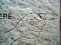

Read more!
Thursday, October 30, 2008
more NaBloPoMo teasers...
 see? i haven't always had gray hair.
this is a picture of me with the Beemans, descendants of the first anglo family to settle in what is now dallas. they still lived on their ancestral land at the time this photo was taken in 1990.
we are standing on the mosaic-in-progress in my studio. the oxen you saw in yesterday's post are part of a tile picture representing the arrival of those early settlers in 1841. the white object at the beemans' feet is my original pencil drawing of that mosaic with a team of mules rather than oxen.
this is the finished product. this slide shows approximately 8 square feet of the entire 300 sq. ft. project. check out the groovy shadows.
here is the wagon in progress and the tools used to make it: pencil, tweezers, carbide hammer and carbide knippers. the caption on the polaroid means it was the 3rd (and final) attempt to render the canvas in tile.
this is sam houston. you saw his eyes yesterday... the 1st mosaic i ever attempted. so gimme a break, already.
and this is the xerox of a 19th century oil painting of sam which i used as the model. edit:
edit:
actually, my very 1st mosaic was this attempt at doing sam's portrait. purty ugly, huh? and the 2nd was this experiment at making his whiskers...
 here is the final product in process. (polaroid, with minimal fire damage.)
i'll leave you with this detail of another of the mosaics within the larger mosaic while i try to figure out how in the cornbreadhell to tell the rest of the story. hey, i've got a whole month, no?
Wednesday, October 29, 2008
3 days and counting...
i signed up for NaBloPoMo.
yeah, yeah, i know. i hardly ever blog anymore, but that's just the point. *maybe* i will now.
 and don't LOOK at me that way, dangnabbit! i swear i'm goinG to try.
 so, beginning saturday, november 1, i intend to blog every day for a month. most if not all of the blog posts will be about the project these photos come from.
stay tuned...

i thought i asked you nicely NOT to look at me that way...


